by David Abbott, Keith Kintigh, and Mary Whelan
The DAHA Project is underway. Funded by the National Endowment for the Humanities, the goal of the Digital Archive of Huhugam Archaeology (DAHA) is to create a comprehensive library of archaeological reports focused on the Huhugam (Hohokam). As we collect new documents from various people and organizations we would ideally like to automatically add as much metadata to the digital files as possible. One widget already in place in tDAR (the digital repository that holds the DAHA collection) is a map feature that lets contributors click on the map to identify the location the document refers to. One click on the map automatically generates geographic key words such as state or province name, country name, and other landmarks where the click intersects. For DAHA purposes, we want to add Huhugam geographic subareas to the tDAR map to generate additional key words (subarea names) for this project. This additional metadata enhances and improves searching.
Huhugam sites are found throughout central and southern Arizona, most located in the river valleys that helped make agriculture sustainable in an otherwise challenging desert environment. Archaeologists conceptualize Huhugam “culture” as a set of geographically separate but interacting communities spread across a large territory and integrated with one another through the exchange of goods and services (Abbott et al. 2007). The regional extent of Huhugam culture is impressive, over 80,000 km2 (31,000 mi2) at its maximum.
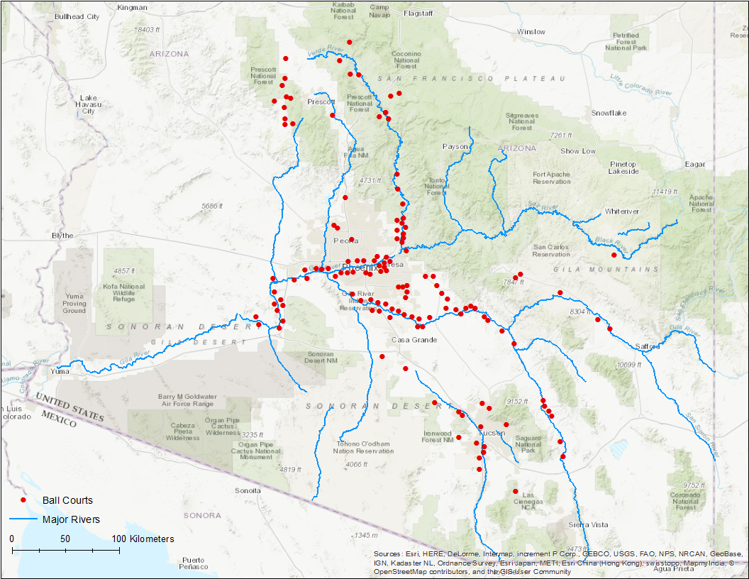
Archaeological sites with ballcourts in the Huhugam region
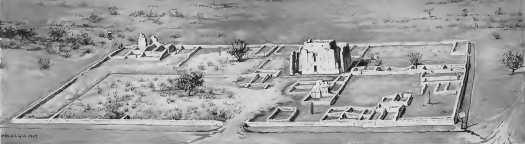
Regional integration was both facilitated by, and is illustrated through, the construction and use of ballcourts – large, oval excavated features that were likely used for a ritual ballgame inspired by similar Mesoamerican practices to the south. Periodic marketplaces, timed to coincide with the ballgames, may have been instrumental for moving high volumes of goods throughout the Hohokam territory. Mapping the extent of sites containing ballcourts is one way to delimit the Huhugam regional system boundaries (map above).
Scholars working in the Huhugam region often refer to smaller subareas named for location (e.g., Phoenix Basin, Tucson Basin) or watershed (e.g., Lower Verde River, Santa Cruz River) (see Craig 2001, Wilcox and Sternberg 1983, Abbott et al. 2007). For the DAHA project we need to delineate these subareas so that we can create a map that will support the automatic metadata creation in tDAR.
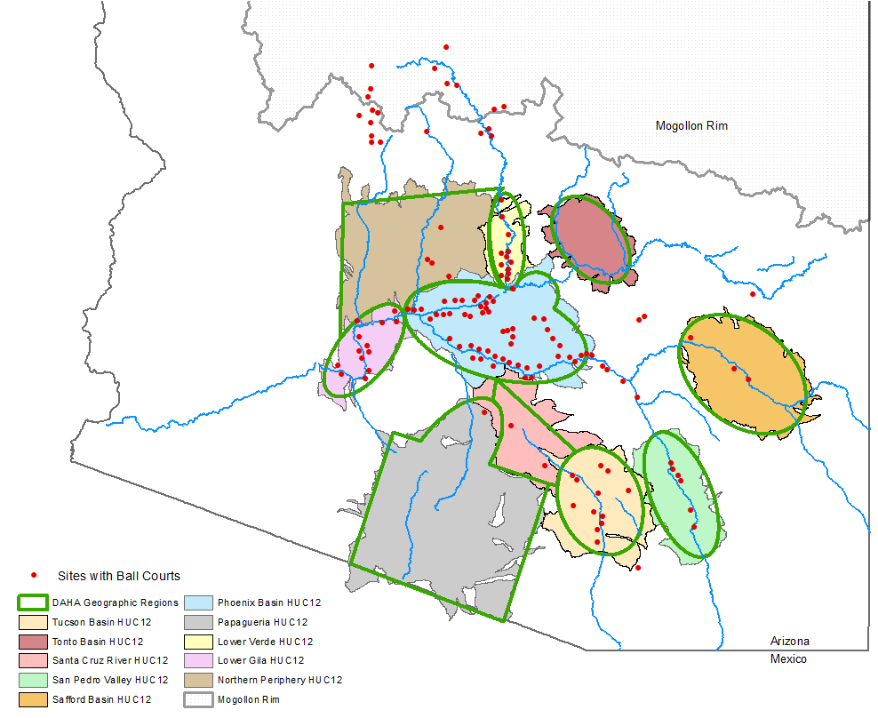
USGS drainage basins (HUC 12) as templates for Huhugam subareas
We are aware that there is no consensus on the exact location of the edges of each subarea, and intend our boundaries to be “fuzzy” – conveying a general sense of place only. To help in delineating the subarea boundaries we looked at the Hydrologic Units mapped at various scales by the USGS (HUC = Hydrologic Unit Code). We merged adjacent HUC 12 drainage basins, smoothed the edges, and used these to outline each of the sub-areas (map above).
The Huhugam regional system also includes large tracts that are not in a major river basin, and are not part of a named subarea, but are nevertheless important areas that were traversed and utilized in a variety of ways. We’ve designated these as Interstitial Areas and together with the geographic subareas, they provide a geographic framework for the DAHA project (map below).
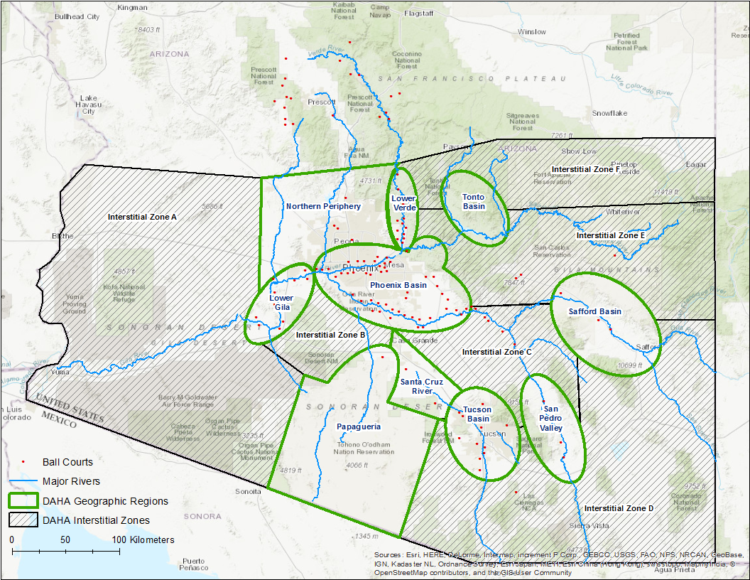
Map of the Huhugam geographic subareas and Interstitial areas
David R. Abbott, Alexa M. Smith, and Emiliano Gallaga
2007. Ballcourts and Ceramics: The Case for Hohokam Marketplaces in the Arizona Desert. American Antiquity, 72(3), 2007, pp. 461-484.
Craig, Douglas B. (ed.)
2001. The Grewe Archaeological Research Project, vol. 1: Project Background and Feature Descriptions. Anthropological Papers No. 99-1, Northland Research, Inc. Tempe, AZ.
Wilcox, David R. and Charles Sternberg
1983. Hohokam Ballcourts and their Interpretation. Cultural Resource Management Division, Arizona State Museum, University of Arizona. Tucson, AZ.